Saturday, 31 August 2013

Day 19

Woke up cold and unimpressed with the accommodation, but still took a while to get going in the morning, which was becoming a recurring theme.  Another recurring theme that unfortunately continued today was the on-off showers.

Plan for the day was to head west and aim for Augusta, in the south western corner of WA (and therefore Australia).  First stop off was Fernhook Falls, which sounded attractive given the amount of rain the area has had but wasn't as spectacular as we thought.  It turns out the river that runs down the falls is full of tanin so the falls were brown and foaming everywhere, so it looked like shit... literally.

Further up the road near the turnoff for Northcliff (our turn-off for Augusta) we did the 48km tourist loop through more karri forest in the Shannon National Park.  The southern loop was pretty good with huge karri trees soaring 50-60m high.  The purple-crowned lorikeet is supposed to be found here but we heard and saw no evidence while there.  The northern loop wasn't as interesting and didn't offer as many spots to pull over and look at things.

We took the turnoff for Northcliff and made ways to Pemberton; in theory a more scenic route rather than taking the highway further north and then SW to Pemberton, which I think paid off.

We stopped in Pemberton for lunch at a local cafe, had a look at what there was to do, assessed the weather and decided to just move on to Augusta.  We stopped on the way to check out Beedelup Falls, which wasn't as poo-brown as Fernhook Falls earlier today.

Not a huge amount of traffic in this corner of the state, which was good.  The drive across the less-populated, highly vegetated south-west corner of the country kind of reminds me of Fiordland in NZ, which is also the south-west corner of the country, although Australia's south west is much less wild, much less vegetated and heaps flatter (though still plenty of rolling hills & mountains) than Fiordland.  Maybe it was the on/off rain that makes it feel similar?  Or that we're exploring it late in our trip?

One into the farmland near Augusta it's a fairly straight forward drive into town.  When we arrived in the late afternoon it wasn't raining and the sun was poking through some holes in the clouds so we took the opportunity to check out the light house and historic water wheel at Cape Leeuwin.  The water wheel was built in the late 1800's and was hooked up to a flow of water from a spring to pump water up to the light house.  The wheel, which was made of wood, as since been calcified in lime.

Augusta at this time of year (August!) is a fairly quiet sort of town - not a lot of action going on, which is fine with us.  Still very pretty coasts and the inlet looked very inviting for exploring on a boat.  We've passed a number of waterways that I'd love to paddle and explore in a kayak one day.  The one caravan park we wanted to stay at was closed for winter... Boo!!!  Obviously the owners don't think it's economically viable to stay open outside the peak season.

Rain was still a threat so we checked into a serviced motel room for the night rather than set up the tent.  Thankfully it had a new reverse-cycle heater/air conditioner and the bedroom and kitchen were separate, so we were much more comfortable than the previous night.

Friday, 30 August 2013

Day 18

We were slow to pack up and move on this morning; the accommodation was so comfortable.

We did a tiny more sight seeing around the Mt Clarence area of Albany before the rain came and spoilt our day again, then found a cafe up the main street.

At the suggestion of the big brown tourist sign we took the Lower Denmark Rd to Denmark instead of the main highway, just for something different, though it turned out to mainly be a slow back country road more than a scenic tourist route.  Feels strange going to Denmark without a passport.

When we pulled in for a pit stop at Denmark Morgs picked up on something on the map between here and Walpole: "Parrot Jungle Exotic Bird Park".  She was very lucky because our other map called it "Denmark Dinosaur World" and the brown tourist sign on the intersection with the road stated the same thing.  Had she not seen the "P" word on the first map we would have driven straight past without realising.

After arriving at the bird park we got out of the car and was greeted with "Hello Darling" from a cocky in a tree over the fence.

At the counter there was a little parrot (Morgs: musk lorikeet) behind the desk on his perch.  When we went to pay our entry fee I noticed the eftpos machine had a cover over it and sure enough the buttons had been chewed! 

Morgs walked straight past the dinosaur bones and reptiles and went outside to the menagerie of birds in cages and trees.  There were about 15-20 birds in trees or in cages just by the door to the reptiles shed.  Syd, the sulphur crested cocky was keen to say "Hello" to the couple he saw getting out of the landcruiser over the fence.  He was also keen to chew the soles of your boots (remind you of anyone??).  There were a pair of red-tailed black cockatoos, two pairs of eclectus parrots, two sun conjures (though they weren't a pair and had to be kept separated), a pair of rainbow lorikeets, a pair of scaley breasted lorikeets, a dusky lorry and a cockatiel... all within arm's reach within 10m of the reptile shed door, and all happy to hang out with each other.

On top of that list, there was a galah (western sub-species, of course) and a couple of western slender billed corellas in the trees nearby.  Most of these birds are hand-tame and will sit on your hand/arm/shoulder and are all very well behaved. 

There were also a bunch of blow-ins who were scabbing all the left over seed on the ground, including Australian ringnecks (28 parrot/Port Lincoln parrot), as well as a number of "straight-beaks" (pigeons, etc).  After about 15 minutes outside with the parrots it started to rain.
That was all within the first 10m of the shed door.  Out the back there was all the aviaries, which contained even more parrots!  When Morgs and I meandered through the gardens (in the rain, which wasn't letting up) we were being followed around by a long-billed corella, who obviously wanted to step up - he kept standing on Morgs' foot which was very cute.  Eventually he stepped up, and was escorted around the park on Morgs' arm. In the aviaries there was a blue and gold macaw, green winged macaw, .... more galahs, more corellas, yellow-tailed black cockatoos, more red-tailed black cockatoos, Carnaby's cockatoos, Baudin's cockatoos (long-billed version of Carnaby), even a red-capped parrot, whom we saw the previous morning at Bremer bay.

The dinosaur and reptile exhibits were also interesting.  The reptile enclosures were set up well - when you looked in you could actually see the animal that you were trying to find, unlike the enclosures in so many zoos.  The dinosaur exhibits were also interesting to compare the relative size of some popular dinosaurs like T-Rex, Triceratops, Stegosaurus and Velociraptor.  Morgan's face fitted into the nose of the Triceratops.  Morgs also took up the opportunity to swap parrots for a python on her shoulders!  She said it felt like wearing a very warm scarf, but was creeped out when it kept moving.  I valiantly declined the offer.

After experiencing the whole park, which was really just the operator's back yard, we both felt thoroughly impressed by their setup.  I think that by the number of exhibits/animals you got much better value here than you would at a zoo - the reptiles could be seen, you could get up close to the dinosaur models, and the parrots were hands-on, although they don't usually do this when there are many kids around.  Still, they usually have hands-on activities at certain times of the day during peak periods.

Right, well moving on to other things now.  We had lunch at Nornalup on the Frankland River arm of Nornalup Inlet.  The rain was starting to die off by now so we went back down the road to the Valley of the Giants and the tree top walk but by the time we got there the rain was still on-off so we passed on the tree top walk but still had a look around the visitor's centre.  There is the story of an old tingle tree that had a huge hollowed section at it's base that was a big attraction for tourists who would come up to the tree and get their photo taken with their cars parked inside the hollow.  The impact from all the people walking around it's base and compressing the earth around it's roots ended up killing the tree and eventually it fell over in 1990 when two British tourists were having their photo taken!  (They were OK).

After doing one more tourist route around Walpole we checked into the first caravan park we found, rather than having Morgs spend half an hour on the phone researching the places first for a good deal.  Big mistake.  For $135 for the night we got a cramped cabin that did not have a couch and the bed & kitchen were the same room.  That was the "deluxe" cabin with the ensuite & bedding; the "budget" cabin for $76 would not have included either of those.  On top of that, the cabin only had a crappy 1980's air conditioner/heater which sounded like a 747 landing over head and barely worked. 

By the next morning we had also found that the bed had the thinnest of thin doonas and even with the extra blanket from the cupboard we were barely warm enough during the night.  Then to top it off the kitchen had ants, which found their way into our food boxes!  Those food boxes are well travelled and have done lots of camping, but have never had ants in them until now.  We will not be staying there again and if you're thinking of staying in a caravan park cabin in Walpole just give me a call and I'll tell you which one not to stay at.


Tuesday, 27 August 2013

Day 17

The plan for the day was to back track a bit to check out the western side of Fitzgerald River National Park, but firstly we thought we'd fill up in Bremer Bay and check out this small seaside community.  For no certain reason we drove down some local streets and found a little boat ramp area that had a pretty outlook over the inlet, but then I noticed some parrots in the trees with a strange "clacka-clack" sort of call.

I called Morgs out of the car and we found the two birds responsible for the noise turned out to be a couple of Red-Capped Parrots - one male and one juvenille.  This is exactly the kind of exciting moment that we hope to achieve while we're on holidays; just randomly stumbling across some relatively uncommon parrots that we can only find in this part of the world out in the wild, yet we weren't actively seeking them out.

We moved on to find our way to the national park, navigating a few good dirt roads.  We got to a sign that stated "You're entering a Dieback FREE area" and words to the effect of "Go wash your vehicle at the wash down area 600m that-a-way or you will be removed from the site".  We went to the wash down area where there was large grate, high pressure pump, a heap of dirty muddy water, and no one to be seen around or any instructions on what to do.  Not satisfied in the lack of supplied information describing what we were supposed to or whether we had to do anything at all, and generally miffed at the whole process I decided it wasn't worth it so we changed our bearing for Albany.

The road to Albany, National Highway 1, felt like it was in good need up an upgrade.  The edge of the bitumen was right next to the white line with a drop-off edge or pot holes in the dirt if you drove over the white line.  The road surface was rather lumpy and sometimes kicked the vehicle left or right.  But worse than that, the surface camber was too aggressive for the transitions going into curves, which meant that as you were entering the curve you had to keep the steering wheel straight, sometimes even turn the opposite direction to the curve, then flick the steering wheel back the other way so you can continue going around the curve rather than steer out of it.  Very disconcerting at 110km/h.  I even had to check that the wheel nuts were all tight (all good).  On top of the bad road we were also pushing through increasingly frequent and intense rain showers, which made me slow down a little at times.

We arrived in Albany about 1:30, which has been our lunch time for much of our trip in WA... probably a hangover from the slow acclimatisation to the change in time zones.  Pies for lunch... we've done well to last this long without any pies.

Driving around Albany we found this town to be much larger than we expected, and actually very interesting.  It reminds me a little of Ballarat with a number of older buildings and undulating terrain.  The main street of town is between two high hills, which were developed with medium residential housing up to a certain elevation a long time ago and offers great views across the town. There are some interesting newer houses in the area, and some nice old houses too, closer to the CBD.

Another feature we discovered of Albany, particularly in the Mt Clarence suburb, was that there are these huge granite boulders everywhere.  The boulders may have been removed if it was a recent subdivision, but thankfully they have been retained as garden features.  The boulders are in public open space as well as private gardens.  Earlier when we had lunch we questioned why the shopping mall was called "Dog Rock"... that was answered when we drove behind the mall and saw a great big boulder that looked like a dog's head with it's nose in the air.  Unfortunately we didn't go back to grab a photo; just search google images for "dog rock albany".

We spent the afternoon exploring the Torndirrup National Park, on a peninsula south of Albany, where there are a few spectacular coastal cliff lookouts and rock formations.  Unfortunately the rain persisted and made the views either uninspiring or invisible, not to mention the fact that we were getting increasingly wet getting out of the vehicle.  We waiting 5 or 10 minutes for the rain to clear for us to see the Blowhole (a real inspiring name for, wait for it, a blowhole), but gave up and moved on to The Gap and The Natural Bridge - two rock formations about 50m apart.

After another few minutes of waiting for the rain to clear we gave up and decided to put up with the rain, knowing that this was the last activity for the day so we could afford to get a bit wet.  The Natural Bridge, again another real inspiring name, is an arch formed in the rock.  The Gap is a big gap in about a rock cliff face, as you probably could have guessed, about 25m high.  The Gap was probably my favourite because the waves were crashing into the rocks at the base of the gap and the spray was going at least half way up the height of the cliffs.

We most certainly did not want to have to pitch the tent and cook dinner in the rain so we booked a serviced apartment for a ridiculously cheap price for what it was.  Sure enough, as soon as we had arrived and set ourselves up the rain dissipated... oh well.  We're expecting a lot more rain in the coming days, so we'll probably be finding caravan park cabins the next few nights as well.

We'll have to come back to Albany to explore it's surrounds in more detail... one day.

Day 16

Time to say goodbye to Esperance and continue heading west.  We followed highway 1 to Ravensthorpe, passing through cropland which gradually turned into arid bushland.  The bugs were thick on the windscreen and we had to clean them off at Ravensthorpe.

We then headed south to check out the seaside town of Hopetoun and the eastern side of Fitzgerald River National Park.  At the self-registration station we were greeted by some more Carnaby's Cockatoos that were flying around the tree tops about 200m away.

The road and car park facilities have been very recently upgraded and it looks like a lot of money has been spent on the park.  We were mainly aiming on passing through for a look and weren't going to visit every nook and cranny.  Besides, a couple of the beaches and access roads were closed due to either road construction work or because of the wet conditions (trying to minimise the spread of dieback).  We exited the park via the dirt section of Hamersley Rd/West River Rd, and back onto the highway about 40km west of Ravensthorpe.

Continuing on Highway 1 south of Jerramungup we took a shorter route for Bremer Bay, heading for a campsite found on the map at Millars Point Reserve.  We weren't too keen on the camping there because there was rubbish scattered around the place, so we moved in to Bremer Bay Caravan Park for the night.

Monday, 26 August 2013

Day 15

Past the half-way point in our trip now!
We had checked the weather report for Esperance yesterday while it was raining (there was phone reception on the beach, but not at the tent 40m away).  The weather report for today was supposed to be sunny and boy did Cape Le Grand turn it on!  I thought about gambling with wearing shorts but played it safe with 3/4 length pants.  My bet on shorts would have paid off because it turned into a brilliant 25 degree sunny day.
The plan today was to drive back to Esperance via the beach, but the high tide around midday meant that we should have been attempting it later in the afternoon, so we left the tent set up to dry and went around the same points of interest that we saw yesterday that really needed better weather conditions to get the most out of.
First stop was Frenchman's Peak.  Glad we chose to do this 1.5hr return walk in the morning because it was getting pretty warm up there on the rock face.  Oddly, the walking trail starts off the climb by walking down the hill then back up to the peak's North East face.  The trail leads to the rock face, which goes straight up at about a 30-40 degree incline.  Climbing up the rock, no ropes or anything, I looked back and thought "If I trip, I'm not stopping until I hit the bottom".  Then I recalled the warning sign at the start of the trail stating "Danger: Bee Risk Area". Riiiight, way to set your priorities.  Turns out there was a sign at the start mentioning the rock face and dangers around it, but there was no highlight symbol specifically for it - just a plain brown/grey national parks sign.
The views from Frenchman's Peak were magnificent and the extensive rock formations were all very interesting to discover and explore. 
We made it back down unscathed and feeling like we had accomplished something. Next spot to visit was Hellfire Bay.  The previous day the Camp Host suggested that this was the place to fish, but by now my bait was past the defrosting stage and had started decomposing so I had to discard it.  When we arrived we saw how fantastic a clear blue sky can actually make this place look.  I would have much preferred fishing off this beach with it's steep gradient and lack of seaweed.  Morgs and I walked it's entire length, noting some of the smaller things like the caterpillars that were walking along the sand towards the incoming surf, then getting pushed back again by the waves.
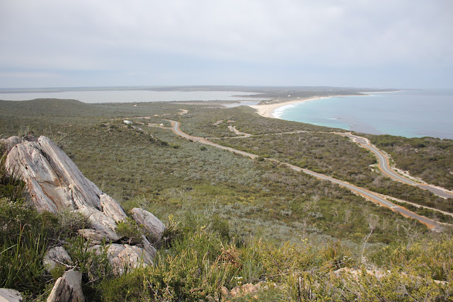
Next we went back to Lucky Bay to take the panorama photos of the bays.  The view was stunning.  Turquoise blue sea, white sand, blue sky, reddish-brown rocks.  If this beach were further north and on the eastern sea board the place would be covered in tourists.  The photo describes it best.
We had lunch at Lucky Bay, giggling to ourselves at a car load of Asian guys who got out of the car, sun screened themselves, went off and got changed, came back to their car and sun screened themselves again, then took a dip in the water.  I was expecting them to be back in 5 minutes to put more sunscreen on. 
I also helped out another guy by jump-starting his car.  Lucky for him we brought those jumper cables.  He was a local who arrived in the park at 7am and went out fishing for the morning with his mates and accidentally left his lights on.  They had a large esky with about half a dozen huge pink fish about 1m long.  They had done well for half a morning's worth of recreation!
By now it was well over time for us to collect our tent.  We packed up and left for Esperance about 1pm - almost an hour after high tide.
The beach was nice and hard at first, then after about half an hour the sea weed banked up on the harder sand and the only tracks were in the soft stuff.  Time to lower the pressures and persist.  A couple of times we even had to put it in low range.
As we got closer to Esperance there were more and more vehicles that we were passing by; many had parked themselves just below the dunes and had the kids and dog running around, mum and dad on the camping chairs, probably a BBQ or two and the odd marquee tent for shade.  What better way to spend a Saturday afternoon when it's sunny and 27 degrees!  Lucky buggers.
There were a few bogans getting themselves bogged in the dunes as well.
We were back in Esperance by about 3:30pm and needed to do more shopping and wash a heap of clothes, so we decided to grab a cabin at the same caravan park that we stayed at earlier in the week.
By now I had some time, and internet reception, to really sort out what was going on with Blogger and figure out why the posts weren't being published.  I think it was due to the number of posts being displayed on the main page, which exceeded the size limit.  Reducing the number of posts on the main page to two seems to have helped.
Next phase of the trip is basically to follow the highway around the coast from Esperance to Albany, Denmark, Augusta, Bunbury and up to Perth.  There are not too many "must do" activities we have, but I'm keen to explore Fitzgerald River NP, and maybe some parts of D'Entrecasteaux NP.

Day 14

Woke up listing to frogs riding their motorbikes again, and drizzle started falling again just after breakfast.  Weather forecast was for "clearing showers", though it didn't specify when the showers would clear.

The plan for today was to check out everything in the National Park, except for the Coastal Walking track - that's for fit people who walk places!  The drizzle/rain persisted all morning and didn't make things pleasant.  We could see that the scenery would look good in normal daylight, but today it just looked bland with the overcast skies.  Walking up Frenchman's Peak was pointless because it was up in the clouds half the time.

We checked out Hellfire Bay, Thistle Cove & Whistling Rock, Lucky Bay and Rossiter Bay.  Frenchman's Peak wasn't really worth exploring because the view would be pretty unrewarding on a drizzly overcast day like today.

Hellfire bay had a pristine steep beach and the surf, albeit small, was clear of seaweed and I remarked to Morgs that it looked like a good beach for fishing.

Thistle Cove involved a bit of a walk to get down to it and wasn't all that exciting.  We found Whistling Rock quite interesting because as you walk towards the rock you can hear an amplified reflection of the roaring ocean, which is about 300m away.  The curved shape of the rock helps focus the sound reflections from a particular direction, which reminded us of the two dishes set up in the gardens at the Parks Radio Telescope in NSW.  We tested it out by speaking a few sentences at normal face-to-face volume and we could work out what the other was saying, despite standing 40m apart with a large bush between us.

Morgs had earlier been feeling a bit bored due to a lack of mental stimulation lately in the trip.  The Whistling Rock perked up her interest with it's unique and natural scientific talent, though I'm completely bewildered by the fact that there is no mention anywhere in the park about this rock, the way it reflects and focuses sound waves, and how it works.  There was no signs at the site and no information in the park notes at the camps.  Most people would probably walk straight past without realising or thinking twice about why the ocean sounded so much louder when standing in a particular spot.

We continued on to Lucky Bay and the drizzle continued to fall.  We drove along the beach (just past high tide) to the lookout on the west side of Mississippi Point.  We found a couple of Sooty Oyster catchers out scrounging on the beach.  When we got to the end of the beach Morgs stayed dry in the car to make sure it didn't get washed out to sea (no chance!) while I ran up the stairs to the lookout to snap a long panorama of the bays. The bays looked fairly clear and the beaches were white, but the grey skies and drizzle really didn't make things look great.

Next visit was Rossiter Bay, which was pretty underwhelming compared to the other beaches; it was carpeted in huge piles of seaweed.  This is supposed to be a drivable beach in & out of the park, which I had been considering taking from Orleans Bay until I decided to wash the car in Esperance instead.  Bloody glad I didn't persist with driving on this beach.That was about all there was to see in the park from the car, and it was only morning tea time! 

We headed back to camp close to midday where I planned to spend some time fishing on the beach behind our campsite and Morgs was going to relax reading her Kindle.  I also took the opportunity to attempt to repair the leak in my airbed.  Up until now I had been sleeping on one of our 2cm thick self inflatable mattresses that we brought for insulation from the cold air beds; Morgs had the good mattress because she's a sook.

It seemed like the rain had stopped for good by now, but the grey skies would continue for some time to come. So I found a patch of beach where there was no seaweed and set myself up to stay there a few hours.  On my second cast I caught a fish!  Something small, about 15-20cm length in total, but I was never intending to keep anything I caught.  I popped out the hook and he caught the next wave back out to the ocean.

Some guys pulled up in a landcruiser ute to mention that they saw a whale and it's calf about 3km back, heading this way about 150m off shore.  I kept an eye out for them the whole 2 hours I was out fishing, but never saw them.  I also never felt any more bites on the line, but I didn't really care.

Late in the afternoon, on the western horizon, the end of the cloud bank could be seen heading our way, which meant it would be great sky & weather conditions for a brilliant sunset photo.  An hour or so later a fellow camper came over to say that a whale was just off the beach and heading south!  How about that? Whale and sunset photos at the same time!!  It turned out it was a mother and her calf - probably the same pair the guys in the Landcruiser saw. 

I tried my best to get a whale & sunset photo but she was heading south too quickly for the sun to set and they didn't quite line up perfectly, but I still got some nice shots.  It feels much more special to have seen the whales off the coast without having paid for the privilege.  Seeing the whales at the Head of the Bight at this time of year is akin to going fishing at the trout farm; seeing them off the coast near Esperance at this time of year is a good chance, but no certainty.  Still, it was a nice rewarding end to what started out as a rather shitty day.

We noticed the number of campers in the park suddenly increased late in the afternoon/evening too, then we figured out it was Friday evening and they were most likely all locals who had come down for a camp after knocking off work.  How good would it be being able to knock off work on a Friday arvo, pack the car and drive an hour/90 minutes down the beach to a National Park to camp a couple of nights, and maybe catch a glimpse of a couple of whales, eh?  Lucky people.

Thankfully our neighbour frogs stopped racing their motorbikes when it was time to go to sleep.  Scuttles McCrab didn't return either.  My airbed was still inflated too, so that was a good sign.

Sunday, 25 August 2013

Day 13

A 20 minute rain shower made packing up interesting.  Thankfully we weren't planning on travelling far so the tent could be packed away soaking wet, no problems.

Yesterday I queried the caravan park manager what he knew about dieback, as I had seen signs in the area indicating it's presence is near.  He said "It's everywhere.  Everywhere you look is infected with dieback".  Given that the land in this area is managed by the Shire of Esperance, it's obvious they don't give two hoots about stopping people from transferring the disease other than by putting up a few warning signs.

Given that we'd probably driven through dieback infected areas the previous day, and that the landcruiser had more than it's fair share of mud than most of the other vehicles around here (a small portion of Merrivale Road from two days prior was being transported in our mud guards) I thought it was appropriate to wash it all off before entering Cape Le Grand National Park.  There would have been a couple of bucketloads of mud that was pressure-washed from underneath.  Car wash owner would be rather pissed off if he'd known.  Too bad.

We took the bitumen road into Cape Le Grand NP.  We checked out both campgrounds before settling on site no. 1 of the first camp ground we checked out (Le Grand Beach).  The waitress from Condi pub was right - the camp sites at Le Grand beach were bigger and better.

As we were setting up the tent we thought we could hear jet skis or motorcross bikes off in the distance, which was odd for a national park.  We could also hear frogs in the creek just behind our campsite.  After a while we had decided that the two noises were correlated and that the frogs there making some weird noise that sounded like someone accelerating a dirt bike up a motorcross jump.

Weather was cloudy, but not cold or rainy.  There were a couple of other campers in the area, but none within earshot. I had already decided we should spend a couple of nights here since there were a number of things to see and do in the park.

We sat around camp relaxing all afternoon, as you do when you're on holidays, listening to the frogs on their motorbikes.

Shortly after going to bed Morgs heard something scratching at the tent on her side, which was starting to freak her out.  We got out expecting to find a possom or similar animal, but instead found a 10-15cm wide crab trying to make a sneaky sideways exit.  He never returned, but we still named him Scuttles McCrab (I wanted him to be called Scratchy McCrab, but Morgs didn't think it sounded very endearing). Unfortunately I forgot to get his picture.

No pictures worth loading for today's blog.  Sorry.

Day 12

After assessing what there was to see and do around Orleans Bay it was decided in the morning that we would break the trend for this holiday and stay put for the day.  No packing up tents and sleeping bags!

Of course I had thoroughly researched this holiday and I already knew roughly when high and low tide would be for the Esperance area around the dates we would be here, and I knew that the tides were not in favour for our holiday activities.  High tide is around 10-12am and low tide around 6am or 5-7pm; pretty much the exact opposite to what you'd need if you want to drive on the beaches in the morning and relax/go fishing in the afternoon.

In the morning we basically explored the beaches that were around - Wharton Beach, Little Wharton, Nare's Bay - which was surrounded by rocks, and the Duke of Orleans Bay - which was carpeted in seaweed. 

Given it was still mid-morning we thought we'd kill a few hours by doing some fishing.  Little Wharton was our chosen bay.  We found a nice spot next to some rocks and tried avoiding the seaweed.  Morgs had one cast and her hook and sinker snapped off the line.  I hadn't even gotten my surf rod tied up when she came back to report her loss, but thankfully she didn't ask for it to be rigged up again.  She had two more casts from the surf rod and was finished fishing, so she read her kindle next to a seagull on some rocks.

I had no luck, but thought there were a few nibbles/bites.

We checked back with the caravan park owner to pay for the next night of accommodation and ask him about fishing in the area.  He recommended Nare's, but we weren't so thrilled about fishing off the rocks.

The caravan park owner kept recommending the Condi (Condingup) pub for meals, so we thought we'd give it a go for lunch.  Other than being the only ones there (it was 2pm) they served very large burgers and we really shouldn't have ordered the extra side of wedges.  Still, it was nice to gorge ourselves on food we didn't have to prepare ourselves.

Talking to the waitress at the Condi pub, we mentioned that the previous day we were hoping to get into Cape Arid, only to be greeted by the flooded track at the end of Fisheries Road and that we had considered going to the campsite at Mt Ragged.  "Oh, no" was her response. "The SES had to rescue someone from Mt Ragged the other week.  I wouldn't go there for a while."

Morgs had a smug look on her face.  I explained to Morgs that that really pisses me off, the fact that someone has gone in there, probably not heard how bad the track conditions were, gotten themselves stuck and then required emergency assistance to get themselves out when the tracks should have been closed to start with.  "How ironic" was Morgan's reaction, not helping validate my belief.
After rolling ourselves out the pub door we headed back to camp to relax for the afternoon.  There were the two caravans on the other side of the park, and another caravan arrived in the evening.  It was a nice quiet time of the year to be visiting the area.  Weather was fine, although a couple of showers came through but lasted no more than 10 minutes.

Day 11

We had to get up early so we could take the car to the mechanic for the service at 8am sharp so that it could be worked on first and we could get away as soon as possible.

The service shop was very accommodating, to be able to fit us in at such short notice (they were willing to do it the afternoon that I booked it), prioritise the job and get us mobile again.  When we dropped it off they even offered us a lift up the street so we didn't have to hang around the workshop for an hour or so while they worked on it.

We chose to have a second breakfast at Dome cafe... mmm belgian waffles with icecream and stawberries.  The time was supposed to allow me to catch up on these blogs, but instead I spent the entire time troubleshooting the blogger app on our tablet.  I'm still several days behind (writing this on the morning of day 13)... it's a bit hard to publish the blogs when the tablet needs to be connected to a decent internet connection (i.e. good phone reception) and the application is buggy and only works half the time.

Soon enough the guy from the workshop was back to pick us up and we were on our way.  He was a nice enough man and we had a good chat about Esperance and what it's like to live there, what there is to see and do around the town, and some of the local news.  I mentioned the railway derailment we saw the day before and he said that happened because they had a heap of rain which flooded the track!  I mentioned that we intended to drive out to Israelite Bay to camp a couple of nights and he said that his mate did it a couple of weeks ago.  He said his mate said "You can choose to get your wheels a bit wet, or you can choose to get your whole car covered in mud", and that basically there's always a deviation route around the big bog holes.  That gave me some confidence that we'd be able to make it. 

At the service mechanic's recommendation we did the tourist loop around Esperance in the morning while the sun was still shining.  The coastline with the beaches and the islands just offshore is pretty stunning - it looks just as good on the ground as it does from the air in a A330 flying between Melbourne and Perth (which was the catalyst for me choosing to explore this area).

After completing the tourist loop we stopped one last time in Esperance to utilise the phone reception - Morgs had to download a book for her Kindle.  At least she wasn't delaying the trip so she could update Candy Crush on her phone again.

So we headed out Fisheries Road to make our way out to Israelite Bay.  I believed the drive would take about 4 hours and we were leaving Esperance about 11:30.  On the edge of town there's a sign explaining which roads are closed - apparently all of the tracks (and therefore campsites) at the southern end of Cape Arid NP were all closed.  That was news for me because those southern camps around Poisons Creek, Thomas Fisheries Camp and Tagon Bay were my backup camps if we couldn't make it to Israelite Bay/Port Malcolm.  For a couple of months before this trip, and a couple of times during the trip I had been watching the Department of Parks and Wildlife (DPaW) website about park or road closures for the areas we'll be visiting and I never saw any notification about Cape Arid being closed.  After seeing the sign  on the road I checked the DPaW website again and there's still no notification that the park is closed.
There were two phone numbers at the bottom of the sign, which I thought I'd call up for more information (as it suggests); The Shire of Esperance and the Cape Arid Ranger. The phone number for the Shire of Esperance went through to a fax machine.  The phone number for the Cape Arid Ranger went through to a message machine.  Not very helpful considering this sign is for people about to head into the park!!!  We don't really have time to leave a message and wait for someone to ring us back when we're sitting on the side of the road with the engine idling.

So we continued along Fisheries Road anyway past Condingup.  We had noticed there were many unofficial bodies of water everywhere; sides of the roads, in the paddocks and crops.  They ranged in size from large puddles to small lakes, and it was quite evident that this area had copped a lot of rain just recently.  There was even a section of road that was completely covered in water - maybe 6-10 inches deep at it's shallowest point on the road.  The water stank too, so it had also been sitting there a while.

Just past the end of the bitumen we saw some black birds that did not have straight beaks; they must be PARROTS!  Sure enough we identified them as Short Billed Black Cockatoos, or Carnaby's Cockatoos (another name for them).  We thought we'd have to go into the National Parks to find them, but here they were on the side of the road.  They weren't too concerned by us being there and there were even a couple in a low tree about 10m away from Morgs, who was snapping away furiously.  We've got lots more photos of black cockies to go with our extensive collection taken from Laura Homestead on the Cape York trip.

Heading further east we could see that parts of Fisheries Road were becoming damaged by the water crossing the road.  Some puddles flowing across the road weren't a problem, but others could only be taken at a crawling pace in first gear, which mandated that all of the unofficial water crossings should be approached at about 25km/h instead of 80.

We got to the end of the formed dirt road and the start of the track to Israelite Bay, still called Fisheries Road, which is on the boundary of Cape Arid National Park.  This track was open to 4WD only, according to the sign back at Esperance, but the main track was covered in water for about 75m and the side track was covered in water for about 100m!  We got out to assess the situation. 

I walked the first 200-300m into the track to discover that at least 50% of the track was covered in water and that from what I could see in the distance it just continued.  This wasn't matching up with the 2nd had report that "you can choose to just get your wheels wet".  The water was dark, but the bottom looked hard and sandy, but who knows how deep the water got and what nasties (sticks) lies beneath. 

Descriptions of the track were that there are holes big enough to swallow vehicles and that there's usually side tracks around those holes, but when the main track and the side track have at least 30cm of dark murky water and who-knows how deep, we decided it wasn't worth the risk in persuing this track and that Cape Arid National Park was going to have to be explored on another trip when it's warmer and drier.
Heading back west, about 500m from the national park boundary we noticed we had a couple of bars of reception, so we tried calling the Park Ranger again - still no answer.  So we called the Shire and asked to be put onto the rangers - success this time!  We asked them about track conditions of Fisheries Road along the Cape Arid NP through to Israelite Bay, and the response: "Gee, uh, I don't know.  It's been that long since I've been up through that way".  I don't even know if the ranger we were speaking to worked in the Cape Arid section.  They advised us to call the Department of Parks and Wildlife, which we did.

The lady from DPaW that we spoke to said "Yeah, we've had a lot of rain recently" (we've figured that already) "and the entire Cape Arid National Park is closed".
"Really?", was my response.  "The sign on the side of the road outside Esperance suggests that only the southern parts of the park are closed and that the roads on the northern side, including Fisheries Road, are open to 4WD only".
"Oh, I'm sorry, I'm not sure about that."
"How long do you think the park will be closed for?"
"We will be reassessing it this Friday", today being Tuesday.
"Hmmm, I doubt it will dry out by this Friday.  We might head towards a different park instead".

We tried to access Merrivale Road, which runs parallel south of Fisheries Road, to get to Duke of Orleans Bay.  The first 200m of Merrivale road was completely churned up and muddy as all hell.  We got through that section and then shortly after the quagmire road continued.  We turned aroud, being careful not to slip into the drains on the side of the road, back through the slosh.  Following my freshly dug wheel tracks helped a bit but there were a couple of moments we were sliding towards the drain.

So, back onto Fisheries Road again, watching out for the first-gear crawl ditches that were being erroded into the track.

Why were these roads still open to the public???

We made it to the Orleans Bay Caravan Park and greeted by the friendly character running the joint.  A pretty little spot, which gets packed out in summer.  We chose to stay for one night, with the option of a second so that we can have time to explore the area.

Day 10

Today we break back into civilisation - Yay!  What better way to start that than warm oats for breakfast, cooked on the resurrected camp fire.  Mmmm warm oats.

Back on the highway heading south we also resurrected our game of car cricket.  The Kalgoorlie-Esperance railway line parallels the highway for much of the way.  At one point we saw a whole bunch of train carriages and bogie wheels sitting upside down next to the track - perhaps there was a derailment recently?  We doubted it had just happened because the bogie wheels had been arranged in a particular way beside the track.

The road south to Esperance is fairly unexciting so I'll bore you with the car cricket scores.  Morgs won the Five-5 match (same as T-20, but with reduced overs) 1/85 vs my average score of 0/67.  I then called it the first match in a Tri-series (yeah, I effectively cracked it and said "best out of three").  We're yet to finish the second match.

We arrived in Esperance and firstly tried to acquaint ourselves with where everything is in the town, since there were a number of jobs we needed to complete before moving on.

Second job: Shopping!
Third job: Maccas for lunch!

I booked the car in at a local mechanic to get the oil and filter changed first thing tomorrow morning.  Months ago I estimated that the oil change would be done around Esperance... my estimate was 454km off the mark!   Not bad estimate I reckon... probably would have been that far over if I did it at home anyway.

Quote of the day by Simon: "Wow!  Look at that huge aeroplane propeller!" (It was a wind turbine prop).

Since we were in civilisation and spoiling ourselves with treats like McDonalds and paying mechanics to service the landcruiser (I haven't done that since the used car warranty ran out), we thought we'd stay in a caravan park cabin to break the monotony of setting up the tent.  The cabin was more like a serviced apartment!  The cabin had modern fittings, soft leather couch, flat screen TV, reverse-cycle air.  We paid $5 more for a cabin in Wudinna (between Port Augusta and Ceduna) and we got genuine 1970's fittings, a cloth-covered couch, 30cm CRT TV and an aviary full of sick or diseased budgies and cockatiels.

We had a couple of hours to kill in the afternoon.  I went fishing and tried out my new surf rod whilst Morgs kicked back in the cabin and watched movies.  I first went to the beach recommended by the caravan park lady only to find that 80% of it is covered in rock and the other 20% was already taken by fishermen.  I found a nearby beach with no one else on it so I could practice my casting, I mean try and catch a fish.  OK, I'll be honest - I really don't know what I'm doing when it comes to fishing.
After taking a few photos of the sunset from the lookout I returned to the cabin to find Morgs asleep watching a chick flick.  If anyone has heard that I enjoyed the movie she was watching please take note that it's a lie - a big, fat flagrant lie.

Mmmm... warm showers and a soft bed to sleep in.

Day 9

It was a fairly mild sort of morning, a few clouds about but the sun still shining through. Just after packing the car to go Morgs noticed some Major Mitchell cockatoos coming... perhaps they heard Morgan expressing her disappointment at them not being at the bird sanctuary yesterday?
One of the Majors was flying within 20m of us.  Morgs fumbled with the camera for a second then gave it to me.  I fumbled with it for a few seconds then just as I was about to take a fantastic shot of it the bird tacked behind a tree and was never seen again.
We headed up the track about half a kilometre to check out the ruins of the Burnabbie Homestead.  All that remains is a timber frame, which has some wire netting over the top like a large cage.  The weeds are climbing up the wire and nature is very much reclaiming the land where some poor souls once worked their butts off to make a living.
With no obvious track back up the escarpment the only main option was to back track to the Eyre Bird Observatory track and follow the main road back to the highway.
We stopped off for a quick look at Cocklebiddy Cave - closed to the public due to "recent rock falls" just like most of the other caves.  This cave has a gradual descent down to the cave entrance, which is below the natural surface of the plain, which is again in the middle of a treeless plain.  Given access into the caves is only granted to the special few who have experience/qualifications and probably some professional reason to be down there, there's really no great appeal to these caves for the average tourist other than to see a hole in the ground and imagine what it's like further in the hole.
We were getting eager to replenish our bread, fruit and vegie supplies, so the decision was made to postpone the Bilbunya Dunes detour until the trip home.  We'll be coming back along the Eyre Highway again, so will be driving past the same turnoff; we just need to allow an extra day when heading home.
Stopped in Caiguna to top up the fuel and our supply of Nippy's flavoured milk (Morgs has got me hooked on that stuff).  Heading west, Caiguna is the start of the 90 Mile Straight - the world's longest straight stretch of road in the world - 145.6km!  Now most people are probably not that interested in this and think it's boring, but from and engineering & surveying perspective I think this is damn unique - where else in the world can you build a road from A to B that does not have to deviate for some cocky's milking shed, or some old timer's heritage listed fence, or some greenies endangered ground-dwelling titmouse.  Morgs certainly didn't find it that interesting and dug her eyes deep into a book she was reading on her Kindle.
Since I was driving the longest straight stretch of bitumen in the world and Morgs was being the most boring passenger in the world, it got me thinking about all sorts of wierd things, like whether GT has won that new proposal we submitted just before I left.
The next form of "civilisation" was the Balladonia Roadhouse - the last one heading west before arriving at Norseman; the town at the end of the Nullarbor crossing.  It was worth stopping here for a break because it was over an hour and a half since stopping in Caiguna and Norseman is another 2 hours further down the road.  You know the jingle: break the drive and stay alive. 
There's an interesting little museum at Balladonia, where they have a bunch of articles and artefacts from the time when Skylab came crashing down from they sky.  There were two pieces of Skylab "debris" - one mounted on the roof of the roadhouse and the other in the museum on display.  Morgs applied her knowledge from Air Crash Investigation and the podcast Skeptoid to "cast her skeptical eye" over the debris.  Why have they only used a single row of pop riverts for a spacecraft?   This airlock handle doesn't do anything. This vent doesn't have an opening on the other side.  Why is a range hood grease filter nailed to it??  I also thought it was strange that the paint was still intact instead of being burnt off on re-entry, and what were the chances that there was a single piece that had a parts of a "United States" logo next to an "airlock", and a bunch of other vents.  We later found a website for the roadhouse that said the museum had some "replica Skylab debris".  Nice try though.
Back on the road we continued west for Norseman, hoping to stay somewhere around there.  The road, although still very straight was now changing in altitude a bit and the vegetation on the side of the road had grown from car-sized shrubs to 3-storey high trees.
Norseman was a strange town.  I realised when I was getting flashbacks to our visit at Iron Knob that it was actually Sunday afternoon and the likely hood of finding an open grocery store was about a snowball's chance in hell.  We pulled out the guide book and found a recommended campsite about 20kms out of town on the way out to Esperance, so we thought we'd leg it for there.
One last thing about Norseman... I've identified it as the town that's made out of corrugated iron.  Many buildings and houses are completely externally build out of sheds.  The Cinema Centre was a glorified corrugated iron shed.  The town hall was a corrugated iron shed.  The local mechanic's workshop was a corrug... well I guess that one makes sense.
Our camp was at Site 9 on the Dundas Historic Trail.  There were fire pits there and someone was kind enough to leave a heap of slightly green wood for us to chop and burn.  It was nice to have a fire, for the first time this trip, but we forgot the marshmallows.  Next stop: Esperance and some proper civilisation.

Day 8

Even though we were the first to arrive in the caravan park yesterday, we were almost the last to leave.  There were plenty of caravans that arrived during the afternoon, and one or two rental motorhome/vans.

It took us a couple of attempts at getting up to speed on the highway.  After descending down the escarpment at the Eucla Pass we stopped to take a photo of the RFDS landing strip on the highway.  Then about 500m later we saw three big wedge-tailed eagles take off from a kangaroo carcass on the side of the road, so we had to get a photo of them too.

The wedgies soon became frequent.  Milhouse would not have been impressed.  Often you'd have to try and identify them 100m before you arrived on the scene so you could start slowing down in case the bird decided to take off in front of the car.  They are bloody slow to get up and mobile.

Stopping off at Mundrabilla Roadhouse we topped up the tanks and sought to stock up our fresh food supply, only to be told the bad news that we wouldn't find anything like that until we got to Norseman, 675km further west!  At the rate we're travelling that would be another 4 or 5 days, so we decided to fast-track our route by cutting out the Bilbunya Dunes.  We'll do that on the way home if we have time.

We intended to break from the highway at Madura and follow the track that follows the bottom of the escarpment along to the Burnabbie Homestead ruins and the Eyre Bird Observatory track, but when we asked about the track conditions at the Madura Bar the barman said "No go. Track got washed out two weeks ago. We had some others try to get through and they had to turn around and come all the way back".  That made the decision much easier for us to take the much quicker, slightly longer, much less interesting route along the highway and down the Eyre Repeater Tower road.  Although we're pushed for time with how long we can live without fresh vegies and bread, we'd still like to see the interesting things on our trip.

So we eventually passed the Eyre Repeater Tower and made it to the top of the escarpment, radioed the managers at Eyre Bird Observatory, and followed the "steep" track down the escarpment where we "might need to engage low range".  Pfft. These West Aussies have nothing on the steep tracks in the Victorian High Country.  First gear, High Range, and the track was graded well enough that the Lancer could have driven up and down the escarpment all day.  The track across the dunes though was a bit sandy, but still no sweat for the Landcruiser.

We made it to Eyre around 2:30ish, had a poke around in the museum and did a couple of the short walking tracks.  Being mid-afternoon we weren't expecting there to be much bird activity, and there wasn't.  Back home Morgs and I call it "afternoon back-beak hour" because there's usually a period where all the birds have their beaks in their back feathers fast asleep.  Albeit slightly disappointing that we didn't see any special birds (we saw a small snake though!) it was still interesting to see the restored building and look around the place.

We took a quick look down at the beach, and the access track to the beach has been covered over by a sand dune now.  I'm not sure where the beach access is to Twilight Cove, but we weren't heading that direction anyway so I didn't care.  We tracked back to the escarpment and turned eastward to camp the night near Burnabbie Homestead ruins.

This was a nice camp, nestled amongst some trees.  Plenty of options to set up some tents if you had a number of vehicles too.  The air temp was warmish too so we knew we we're in for a good night's sleep.

Sunday, 18 August 2013

Day 7

Our plan for today was to drive the hour or so across the border, surrender what's left of our fruit and vegie supply, then head on into Eucla 13km into the WA border and restock.  Well... it turns out that I misinterpreted the guide book and that Eucla doesn't in fact stock any food supplies other than icecreams, defrosted frozen milk and packets of lollies. Mmm... nutritious.  We still have plenty of meat and a few tinned or dehydrated vegies, so that should keep us going for a few more days yet.

There were a few things around Eucla that we wanted to see, so we set up camp early at the caravan park there.  For us it was 11am, but really in WA it was 9am.  In actual fact, Eucla has given the city the big middle finger and said "stuff you, we're thousands of kilometres east of Perth, so we're adopting our own local time".  So just to make things ultra confusing the real time in Eucla was 9:45. Why not just call it an even hour ahead of Perth??  Why just 45 minutes?  Doesn't matter anyway, we're operating by sun-up and sun-down anyway. 

After we set up camp we went for a short drive down to the ruins of the old Eucla Telegraph Station.  Note to self: Do not build a house next to sand dunes, or you'll be forever sweeping the floor... and the walls... and the ceiling.  I couldn't resist myself and we let the tyres down to drive on the sand track down to the beach where the old jetty is and then have a drive along the beach.  Got to the jetty and the ocean greeted us at the entrance to the beach - it was well and truly high tide.  So much for beach driving here. 

With all afternoon left to spend we decided to go check out Weebubbie Cave.  This cave was featured on an episode of Catalyst earlier this year, and is known for it's underwater lakes and cave diving.  It's not open to the public anymore, and with good reason - you would need some serious abseiling/rock climbing gear and experience just to get to the bottom of the 10m drop into the cave floor and entrance.  Our understanding was that entering the cave was closed to the public, but viewing the cave entrance (the big hole in the ground) was not.  It's still a mighty impressive hole in the ground.

On the 250 thou map sheet there's also Weebubbie Road Blowhole marked just off the road a few kms from the cave, so we went in search of that.  There were no obvious signs or tracks directing where the blowhole would be, so we followed a pair of wheel marks off into the bush to the point marked on the map.  Still couldn't find it, so we made tracks back to the road and back to Eucla.

The last half of the afternoon (which was really only a couple of hours) was spent relaxing at camp. 

Have you ever seen the sun set at 5:57 in Australia?  We were in bed by 6:30... how sad.

Day 6

Woke up freezing cold.  The clear sky stayed with us all night and the temperature plummeted to a chilly 6 degrees in the morning.  The ever-present morning nullarbor wind didn't make it any easier.  With bitterly cold fingers I made breakfast and Morgs had her warm oats served to her in bed.  Eventually we got under way and headed back to the roadhouse, where we filled up the gas bottle, which ran out the night before.

We took the scenic route south of the Nullarbor Roadhouse, which is a dirt track that follows the cliffs along the coast line; a little too close for comfort at times.  After successfully not falling off the cliff faces Morgs also managed to avoid dropping us into a giant wombat crater.  If she braked one metre later we probably would have gone in.

We decided we'd set up camp at Koonalda Homestead because we had read that it was an interesting place to have a look around.  It is only about 100km west of the Nullarbor Roadhouse so in terms of movement heading west we didn't achieve much.  Besides, it gave us an extra night to consume our vegie supply before handing it over at the WA border down the road. 

We found Koonalda Homestead interesting, but bearing too much creepiness with all the old car bodies and other junk strewn around the place.  It was 3pm and we decided it was too late to find another campsite, so we made do with the clearest patch between some trees out of sight of the car bodies.

Expecting another freezing cold night we rugged up with several layers, only to find that it was not required due to the cloud cover over night.
 

Friday, 16 August 2013

Day 5

We were woken up about an hour and a half before sunrise.  The wind had picked up and blown our tent half over.  Out we jumped, just as the rain was starting to come down, and we bashed in a few sand pegs to sturdy up the tent. 

By sunrise we were keen to pack up and get out of there, although we still couldn't help admire the serenity and beauty of the area.  We picked our way through the woodland and heathland whilst twisted eucalypts and scrubby saltbush took their turns at and scratching themselves all the way down the side of our car - from headlamps to tailgate.  Meh - I bought it to be used as a 4wd, not a show vehicle.

Within an hour and a half of 10-20km/h driving we were back on the blacktop heading for the Head of the Bight.  This was about as far north as we're expecting to get for the trip, and it was a nice sunny 25 degree day... why do we have to start heading south again?!?

Shortly after rounding bend to start heading south we noticed the vegetation had become rather void of trees and that the terrain was very flat... there was null arbor on this plain, if you will.  It's quite incredible, actually, and the fact it stretches on like this for hundreds of kilometers is quite unique.

We stopped off at the Head of the Bight and paid our $15ea to access the whale viewing platform.  Thanks to pure fluke timing for our annual leave we happened to be there during the peak whale season!  There would have been about a dozen mothers and calves swimming along within 100m of the cliffs.  Who knows how many were further offshore, but a sign out the front of a tourist company in Ceduna said there were 120... certainly not today!

We probably spent about an hour or so watching them swim and play around.  According to the information boards there the calves learn certain whale traits here like tail slapping and waving fins in the air.  There was plenty of that going on and you could see the calves were all trying their best.  The mothers would occasionally come along and show the littles ones (how's that for an oxymoron!) how it's done!

As for the whale types, I believe they were southern right whales, as opposed to the northern wrong wails.  We had lunch before we left, then continued on to the Nullarbor Roadhouse, which kind of creeps up on you out of nowhere.  Quote of the day goes to the service attendant at the roadhouse.  Hippy in a van walks in, doesn't ask to pay for petrol or anything else and asks "Do you have any water here?".  The service (sic) attendant straight away states "No. We're in the middle of the desert. Next."  Fair enough then.  I think  he gets asked that question quite a lot.

To mix things up a little we headed north of the roadhouse about 10km to Murrawinjie Caves.  Apparently these were the one of the only cave on the Nullarbor Plain that are open to the public, however when we arrived we decided there was no way in hell we were climbing into them.  All three caves are basically a big circular hole about 20-30m diameter with shear rock cliff walls.  You would have to have rock climbing equipment with you to abseil and climb out of the caves.  One of the caves had a bit of a step that you could walk down into, but with all the rocks that have fallen I wouldn't take my chances.

We set up camp at the third cave.  Up to this point in the trip this was our most favourite camp.  At first glance you think that this place is just vast, raw nothingness, but after a while you appreciate what is actually out here.  Despite there being no trees within sight, there are still several Australian Kestrals (according to the sign at Cave 1) who roost in the hollows of the caves and harass the Welcome Swallows (Morgs looked them up in her bird book) who also roost in the same caves.  How'd you be living in the same house as the animal that is trying to eat you every day?

In the daylight we could see nothing but small saltbush scrub, birds trying to eat, and birds trying to not be eaten.  Even the roadhouse was invisible, 10km to the south.  However once the sun's gone down, with the clear sky we received, the sky is lit up with arguably the widest most uninterrupted view of the stars.  No hills to get in the way.  No cities to pollute the light.  Although, to the south we could now see the flickering lights on the horizon, and occasionally the odd car from the highway, thanks to the 'fata morgana mirage' (I learnt that from listening to podcasts of Skeptoid the following day).

Day 4

Aim for today is to continue heading west and find a nice campsite.

We packed up and left Point Sinclair camp about 9ish, then quickly popped in to check out Cactus Beach, nearby. Pity I don't surf, as the morning waves looked particularly surfy (excuse my inadequate surfing lingo).

We moved on towards Fowlers Bay via as much dirt roads as we could find. Chadinga Conservation Reserve offered a few potential camps with fire wood, but at 11am that was pointless for us.

We arrived back onto the Eyre Highway at Bookabie then drove 200m to our next dirt road turn off for Fowlers Bay.

Lunch was had in Fowlers Bay. Not a lot else going on here other than a few bored holiday makers in the cafeteria of the caravan park who constantly stared at us. Had they not seen a motorised vehicle before?

Next we made tracks for Wahgunyah Conservation Reserve to try and find a camp by the beach and spend the late afternoon relaxing and fishing (don't both of those go hand in hand?). The plan was to follow a track that lead along the coast behind the dunes.

We kept getting delayed by trying to stop and photograph the Port Lincoln parrots, but by the time I've stopped the car they have flown off 500m away from the road!

We pushed on into the Wahgunyah Reserve. Mallee scrub, heathland scrub, sand dunes, ocean cliffs... This place was pretty damn scenic. Only problem was that the campsites were few and far between, and none in our vicinity would allow access onto the beach for fishing.

We pushed on past 3pm. 4pm. Eventually at 4:30 it was decided to make a camp on a flattish piece of dune next to the track because it was clear the other campsites in the reserve were too far away. No point moving the car off the track because there were no signs that anyone had driven this track for a while.

The plan was made to backtrack in the morning. I was concerned that we were too remote for just the two of us. But the camp and the environment was pretty darn spectacular, nonetheless. 

At dusk we were treated to a few pairs of Major Mitchell cockatoos flying back to their hollows. None of our photos were all that great.

After dinner, after sunset, we hit the hay... again at 7pm.  The wind eased off overnight and the peace was immense.